River Irvine
Ayrshire’s second largest river rises above Loudoun Hill on the boundary of East Ayrshire and Lanarkshire.
The Irvine flows for 42km westwards to Irvine Bay on the Firth of Clyde.
It shares an extensive estuary with the River Garnock. This is the only significant estuary in Ayrshire, providing excellent bird habitat.
Principal land uses in the catchment area are agriculture, forestry, and urban development, the largest settlements being Irvine, Kilmarnock, Stewarton, Galston, Newmilns and Darvel. The river has been highly modified, particularly where it flows through urban areas, with many weirs, culverts, retaining walls and extensive levies in the lower catchment. There is a large flood prevention scheme between Hurlford and Galston designed to prevent flooding in Kilmarnock.
There is no formal catchment wide fishery management organisation, with clubs each taking responsibility for managing their own beats. Both Irvine and Garnock are covered by the West Strathclyde Trout Protection Order and anyone fishing for trout or salmon must be in possession of a permit obtained for the necessary beat that they are fishing. Clubs can issue both day and season permits.

River Irvine Catchment Map highlighting main tributaries.
Support us!
Every small donation helps! Payment by credit/debit card is quick and easy.
Key Features
General
- Medium-sized river with catchment of >380km2. Second largest catchment of all Ayrshire rivers
- Rises above Loudoun Hill where it is known as the “Wee Irvine”
- Headwater’s of the Craufurdland Water have been impounded for water supply reservoirs. There is a compensation flow of 1.7Ml/day
- Ayrshire Rivers Trust and Kilmarnock Angling Club eased the barrier of Blackrocks Waterfall in Kilmarnock in 2012, since then natural salmon spawning has been taking place on both Craufurdland and Fenwick waters. There has been limited restoration stocking of this area to assist with recovery
- High human population density equivalent to 295 people/km2 within the catchment
- The Irvine is a priority catchment under SEPA’s diffuse pollution initiaitve. Inputs arising from landuse impact on bathing water quality and this initiative seeks to address pollution at source
Catchment Characteristics
- Major tributaries are the Glen Water, Changue Burn, Cessnock, Fenwick and Craufurdland Water, Kilmarnock Water, Carmel Water and Annick Water
- River is extensively urbanised where it flows through settlements of Darvel, Newmilns, Galston, Hurlford, Kilmarnock and Irvine
- Annick Water is the largest tributary with a catchment area of 91km2
- Landuse in the catchment is dominated by agriculture and forestry
- The source of the Irvine rises upstream of Loudoun Hill which is a volcanic plug
Land Use: past and present
- Historic Mill Dams remain a feature of the catchment and these continue to pose serious obstacles to migrating salmonids, although most are passible to some extent. Several barriers have collapsed through lack of maintenance. Some dams have fish passes but most do not
- Weirs impact not only on upstream migrating adults, but also are extremely detrimental to downstream smolt migration and they interupt sediment transport which reduces the quality and quantity of spawning substrates
- Sewage within the valley is pumped to the coast for treatment, replacing the historic treatment works that used to be a significant impact on water quality
- Water quality in many reaches of the main river and tributaries suffer from the impacts of diffuse pollution, primarily from agricultural land use. 62% of catchment land use is improved grassland. Point source inputs continue to be discovered and highlighted to SEPA for improvement
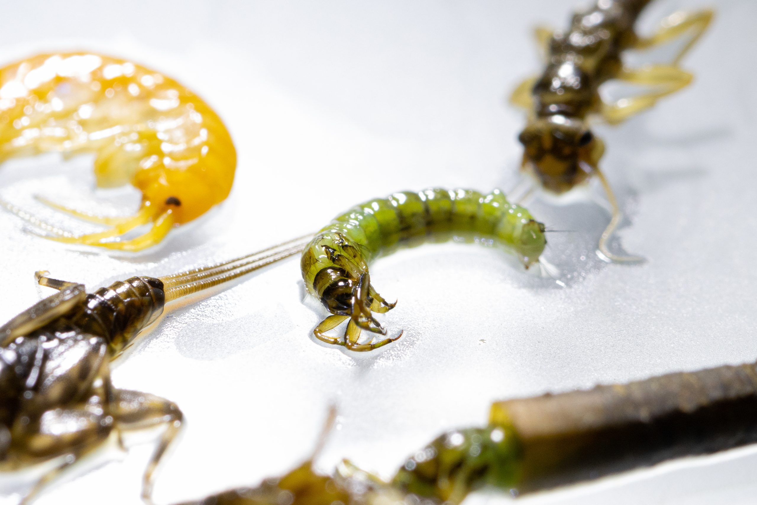
Biodiversity
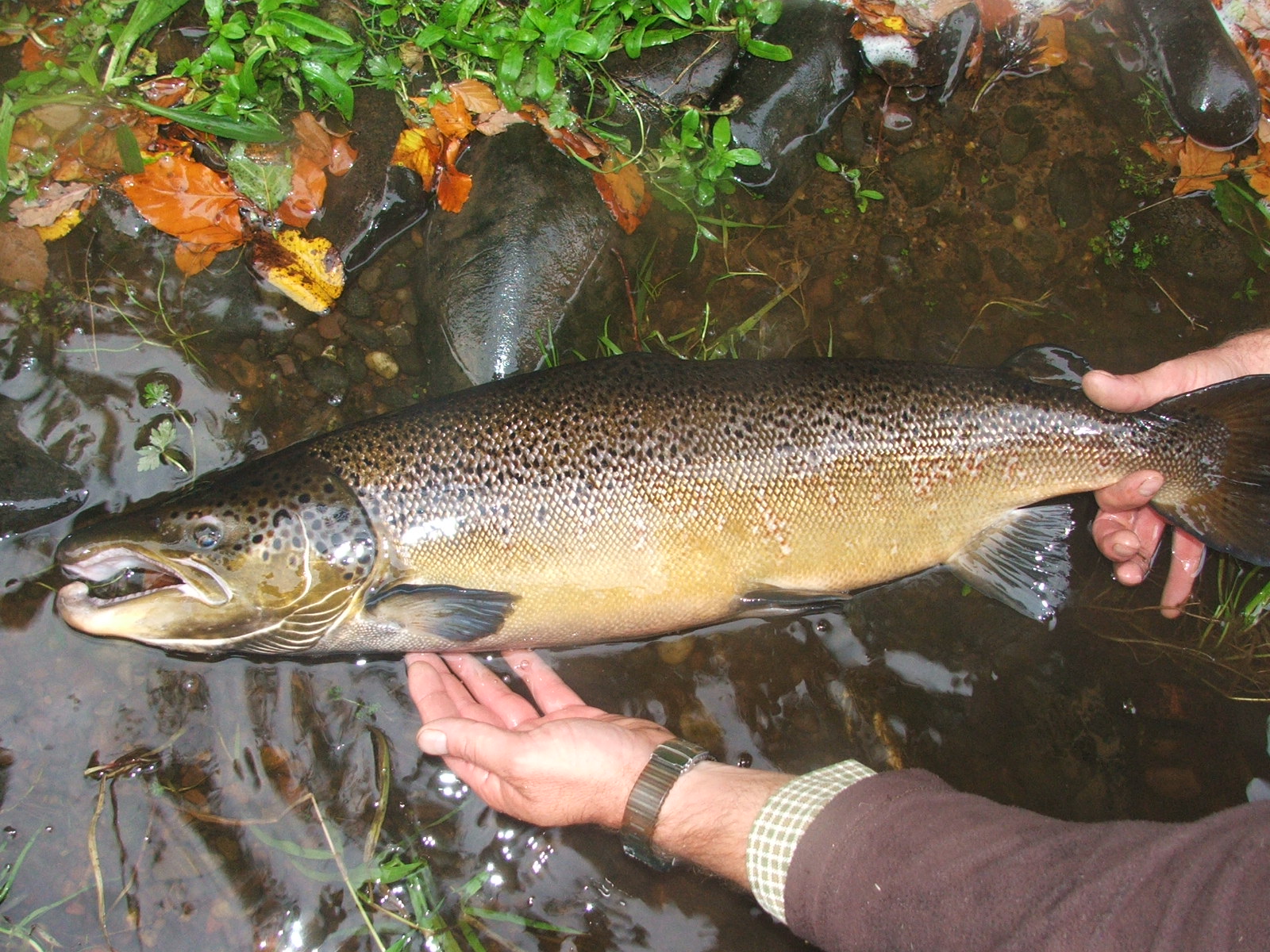
- Indigenous fish species to the Irvine include salmon, trout, eels, lamprey species, minnows and sticklebacks. Many other species have been introduced, many of which survive and threaten the native stocks, these include: Gudgeon, Tench and Stone Loach (there may be more)
- Grayling population, which were introduced in the 1850s, is thought to have died out
- The Irvine’s population of Freshwater Pearl Mussels is thought to have died out
- Watervoles remain in low densities in some areas
- Otter numbers have increased from the all time lows recorded in the 1970s. White otters (possibly albino) have been sighted frequently in and around Galston
- Kingfishers, Dippers, Herons and a variety of duck species are all common along the length of the river
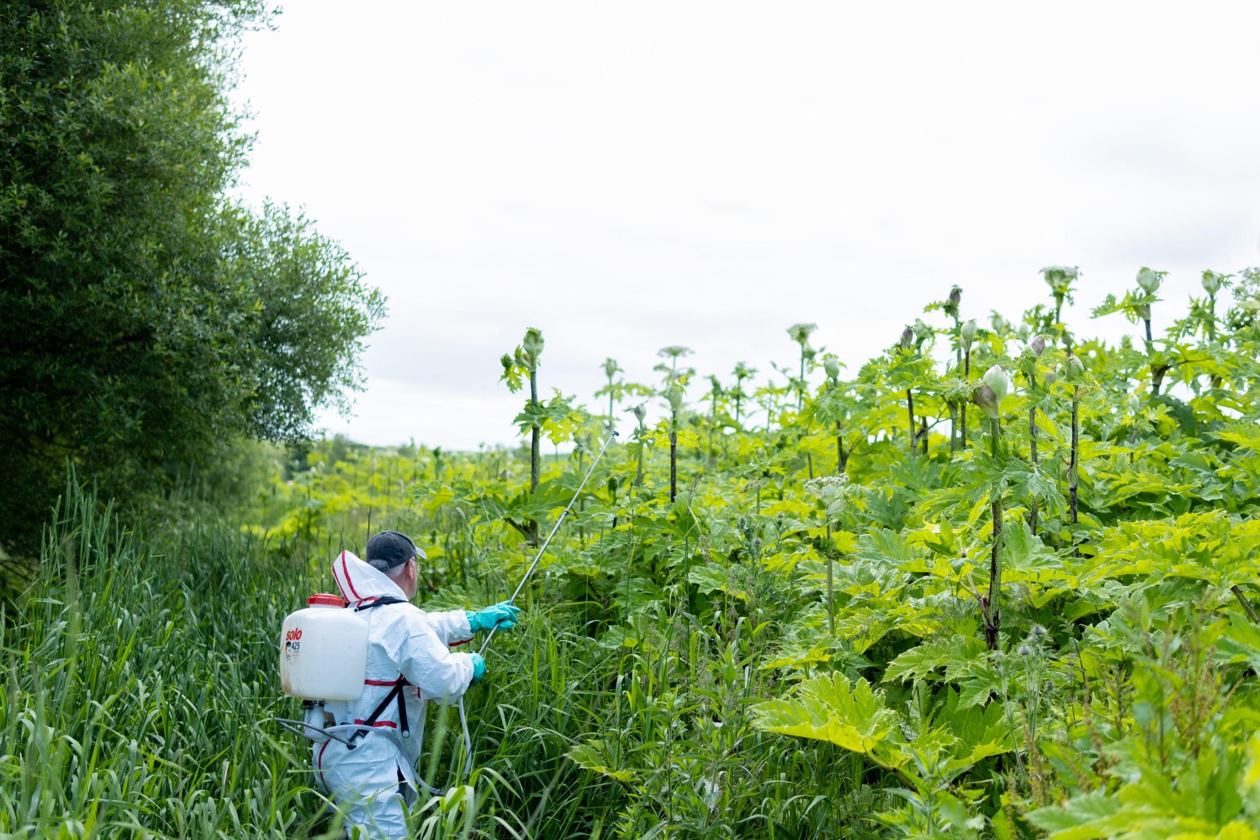
- Himalayan balsam, Japanese knotweed and Giant hogweed are all non-native, invasive plant species which have been introduced within the catchment. These plants are detrimental to river processes and lead to erosion and a reduction in biodiversity. Currently, no stratgeic approaches are being implemented to address these issues
River Irvine Gallery

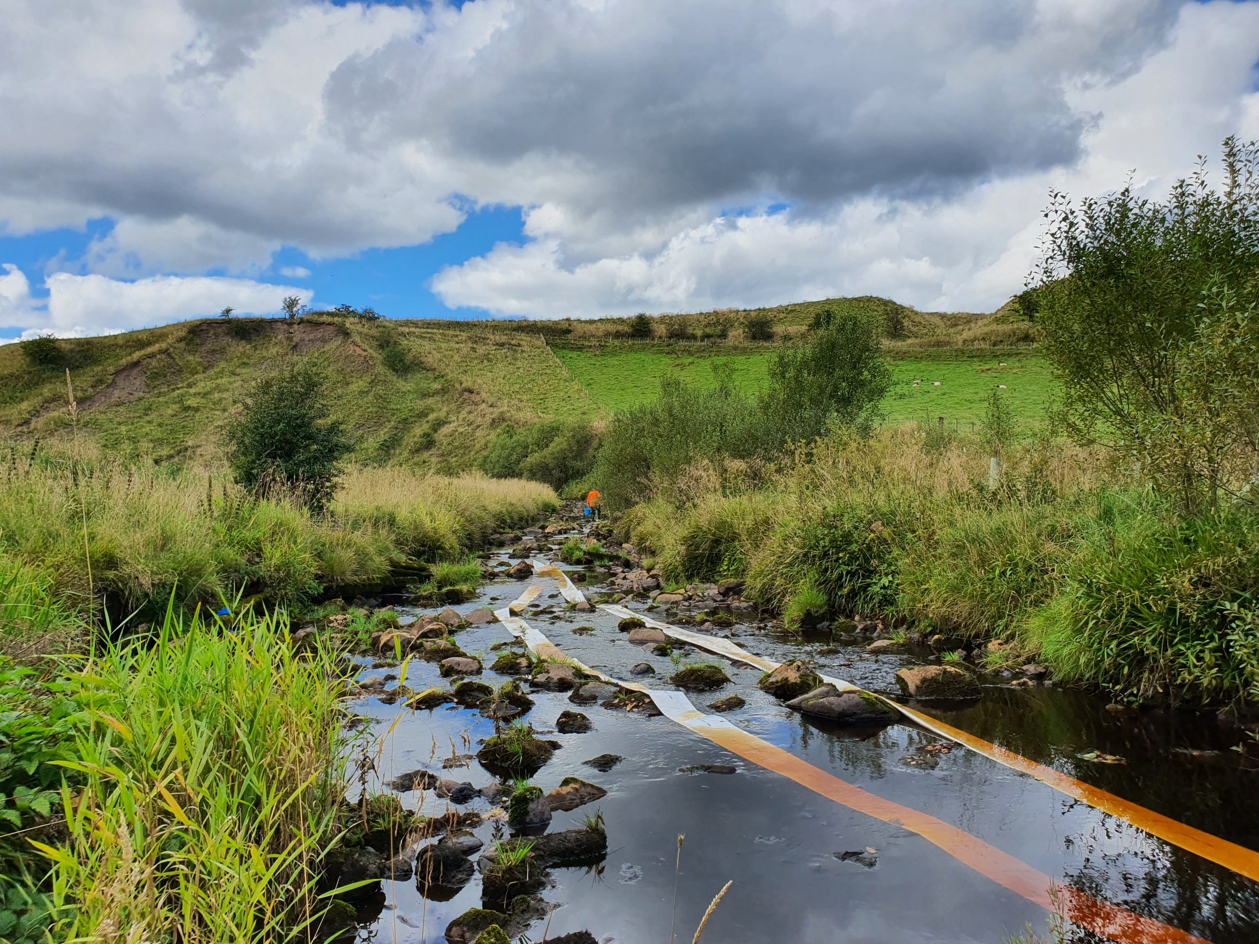
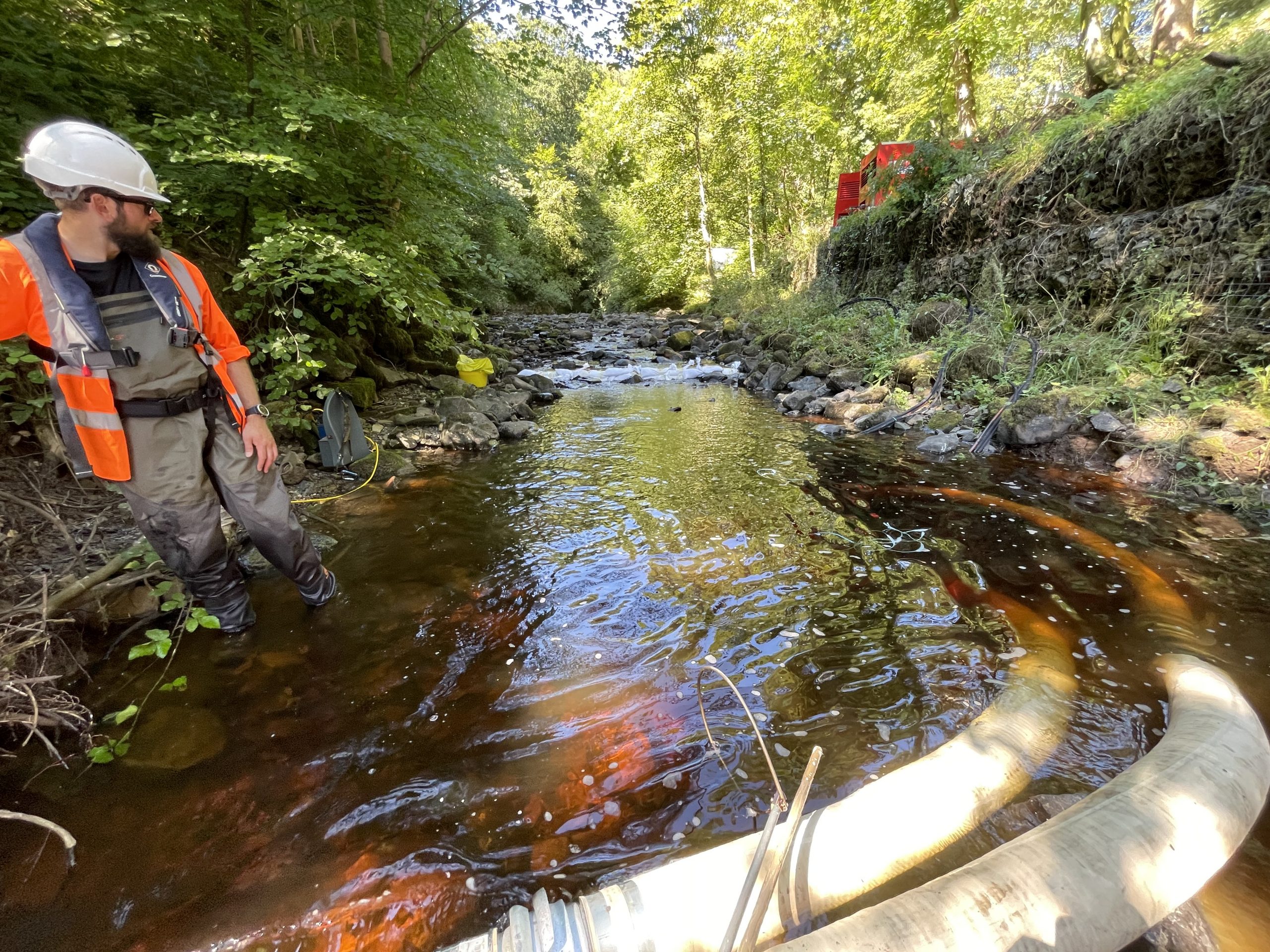
Monitoring and Science on the River Irvine
Data is collected to allow evidence based management and restoration