With the sun shining, I had a look at a few things on the upper Ayr today. It’s been a while since we’ve been able to use the drone to identify issues or to re examine those we already know about. Having another perspective sometimes reveals things you miss on the ground. At least, it often provides an interesting perspective of familiar waters.
I checked Ashaw Burn that ART have only ever surveyed on 1 previous occasion back in 2008.There are 2 culverts on the lower section of the burn and we had surveyed between them. Today I used the drone to check the second culvert for access and the habitat upstream. Fish passage appears unhindered and the habitat looks as though it offers potential. I flew the drone some distance beyond. We will survey this burn in more detail at the next opportunity but that will be next year.

The second culvert taken remotely from the drone.

Further upstream, the landscape is post industrial however there are good buffers created by water margin fencing and water quality should be good.
I also looked at the Stottencleugh Burn for signs of trout spawning but nothing yet. This is where we normally see the fist signs of spawning activity in the Ayr catchment but few reads are successful (if any) due to historic mine discharges.

With no dark patches on the gravel, it was easy to see that spawning hasn’t yet commenced on this burn.
Further downstream I stopped at the eroding bank in Muirkirk to see how it had held together since rock armour was placed last year. All seemed well with this although I may suggest more trees are planted on the slope.

Essential repairs to stabilise the erosion and protect caravans at the top of this slope were performed last winter. Things seem to have stabilised.
I nipped across to the upper Greenock where the culvert has yet to be improved. This is on the board’s hit list for improvement. Upstream of this culvert, there is excellent spawning habitat but water levels through the culvert often prevent salmon reaching them.

Good habitat in a largely unmodified burn
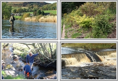
The Whitehaugh Falls on the Garple Estate is the upper limit of migration as it appears impassable as there’s too little depth for salmon to generate adequate power to leap these rather innocuous looking falls. I did notice a heron fishing at the top of the falls and I expect it was after trout that may just manage over. This has prompted me to have another look at the depth in this area just to check to see if salmon could possibly make the leap. Anecdotal reports from the keeper suggest that his grandfather remembers the odd salmon making it over.

The heron was there for a reason and we will recheck these falls to see the depth below the spot where it was fishing.

