I regularly check the Scottish Environment Protection Agency web site for the latest hydrographs detailing river flows. SEPA has Gauging stations on many rivers and burn across Scotland where they monitor daily flows and the data collected is published on their website http://www.sepa.org.uk/water/river_levels/river_level_data.aspx. The hydrographs generated from SEPA’s data are updated at least once every day and some more frequently. The Fish Pal website http://www.fishpal.com/Scotland/Ayrshire/RiverLevels.asp?dom=Ayrshire also provides river level data generated by SEPA. Farson Digital Webcams are another a useful resource for river users to get up to date information on flows and water conditions at http://www.farsondigitalwatercams.com/ . Farson cams update every 10 seconds and can be used to check not only the height of the river but also the water conditions.
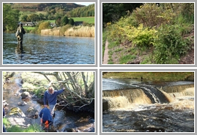
With ART regularly working in and around rivers, these resources are invaluable to us to save time or rearrange projects or work to suit conditions. This was particularly important when the contractors were in the Kilmarnock Water constructing the weirs. As the Blackrocks project has now been completed, yesterdays spate was the first really big one to test the structures and I was interested to see how things looked in a big water. The Hydrograph from SEPA’s site indicates that the peak flow was around 10.00am and topped 1.6m. Unfortunately I didn’t manage to time my visit to the peak flow but 9 hours later at 7.00pm the height was 0.8m and still very impressive. 
 We cancelled a School visit to the River Ayr on Friday due to the weather and for safety reasons. The hydrograph taken from the Mainholm Gauging Station on the lower river Ayr clearly shows the dramatic rise in level between 1.00 and 2.00pm on Friday 22nd. The Farsons Digital Web Cam at Tarholm Bridge recorded this rise shortly before it reached the Mainholm station. Compare the images from the 22nd June in the gallery section of their site to see the rapid rise between 1.00 and 2.00pm. The Lugar and Catrine hydrographs from upstream both showed large rises earlier that morning.
Looking across Ayrshire, all our rivers showed similar rises as expected. A large proportion of the Doon’s flow is regulated by Loch Doon Dam and the impact of this can be seen on the hydrograph which is quite different to our other rivers.The Doon rises more slowly and maintains its level for longer. All hydrographs are downloaded from SEPA’s site. Other Ayrshire watercourses are available too but I haven’t included them here to save space.